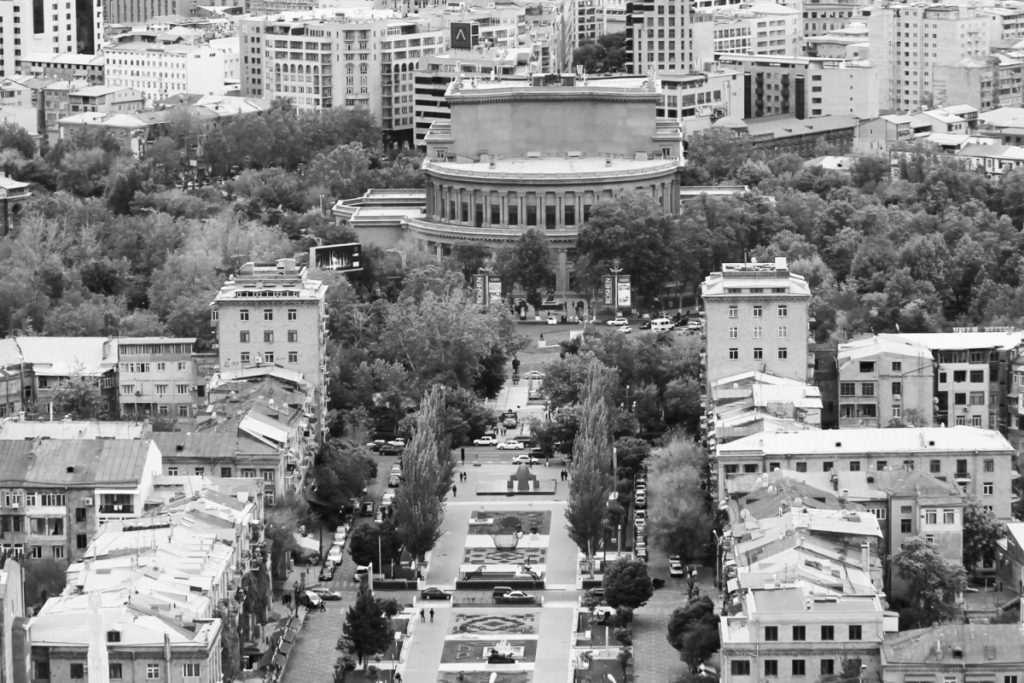
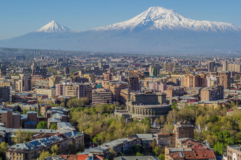
Currently, the capital of Armenia is Yerevan. It has about 1,1 million population. Yerevan is also the largest city in the Republic of Armenia.
It is the most important transport crossroad. Yerevan is a political, economic, cultural as well as scientific center. The capital city has 2 airports and also a metro since 1981. This historical city is more than 2800 year old. It has been the capital of Armenia since 1918 and is the 12th in the history of the country.
As you already saw above, Yerevan is the 12th capital. This means, that Armenia had other significant capitals throughout its history. This article is all about these 12 capitals of Armenia.
Armenia is one of the few countries in the world to have many capitals in the history. They are the following: Van, Armavir, Yervandashat, Artashat, Tigranakert, Vagharshapat, Dvin, Bagaran, Shirakavan, Kars, Ani, and Yerevan.
Even though historians have counted only 12 Capitals of Greater Armenia, they haven’t included the Tsopq, Commagene, Cilicia, Small Hayk and other Armenian state units, which had their own capitals.
Historians claim, however, that the roots of the Armenian statehood are much deeper, meaning that there were other capitals that we don’t know about (yet!). All these cities are an inseparable part of the Armenian history. They are also the symbols of the statehood.
It is no coincidence that the main elements of Yerevan’s city hall building are the memorials of all the old capitals of Armenia.
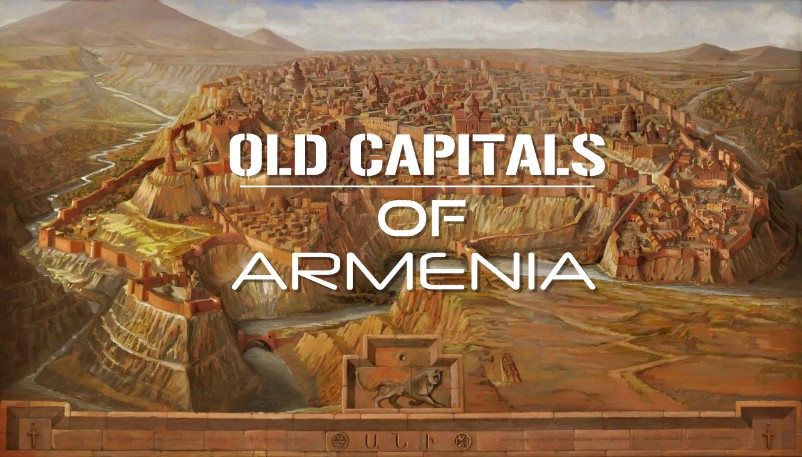
OLD CAPITALS OF ARMENIA
Here are the capitals which preceded the current one, Yerevan throughout the history of Armenia.
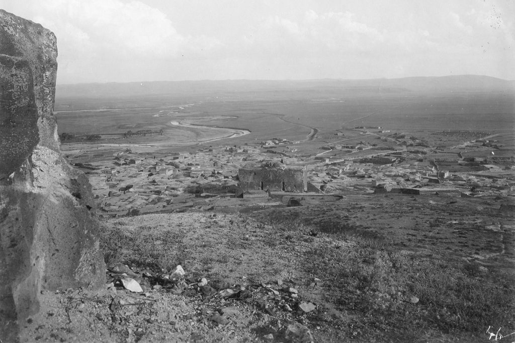
VAN
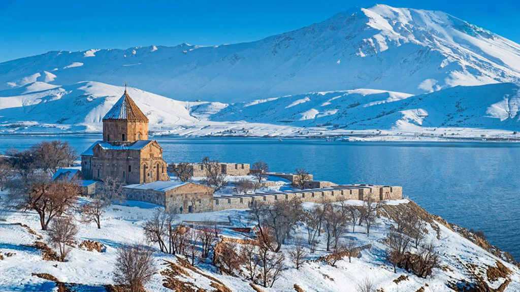
Van is one of the oldest cities in the world which exists since its inception till our days. It also has various names: Tushpa, Biaina, Tosp, Yervandavan, Vantosp, City of Shamiram and other names. It is located 2-3 km east of Lake Van, in the Tosp canton of the province of Vaspurakan.
According to the traditions, Shamiram queen of Assyria established the city. However, the founder is actually the king of the kingdom of Van or the city of Urartu, Sarduri the First (reign: around 840-825 BC). He named the city Tushpa and made it the capital of the state, which then expanded during VIII-VII centuries BC.
When King Sarduri the First moved the royal palace to Van, he built the temple of Shivini, the god of the sun. Tushpuea (one of the city’s names) was his goddess, holding the sun above her head.
This city had gorgeous gardens, gardens, and flower-beds. Hence, there should have been a lot of water! In the 8th century BC, a huge canal of 70-80 km was built there. The canal was a unique structure for its time, with a width of 4.5 m and a depth of 1.5 m.
This canal of Menua the First (810-786 BCE), which had been operating 40 centuries after the construction, did not hold the name of its owner, Menua. Instead, all the glory went to Shamiram.
Interesting to know
One of the seven wonders of the world is Babylon’s famous hanging
garden. A similar one, however, was also in Armenia, Van, and the author of that magic was also Menua the First.
During the reign of Rusa the First (735-713 BCE), Van was very crowded. It was a huge city. 5507 people lived in the royal court alone.
According to the royal staff list of Rusa, there were 1113 outstanding people or courtiers, 3784 officials, 152 servants, 10 winemakers and 400 other people, apparently soldiers, craftsmen, clergymen and juvenile officers, who lived in the royal palace.
The royal palace of the ordinal Armenian reigning dynasty, the Yervandunis, was also in Van till 331 BC. In 908-1021, it was the capital of Artsruni kingdom of Vaspurakan.
Gagik Artsruni founded the Vaspurakan Kingdom in 908 and declared the capital as Van. The royal status of the city is preserved until the fall of the kingdom of Vaspurakan in 1021.
Early Modern Period
With the Amasia (1555) and Kasre-Shirin’s (1639) Turkish-Persian peace treaties, the city passed into the Ottoman sultanate. It became the Van vilayet center. According to the XVII century historian Arakel Davrizhetsi, the city suffered greatly from the 1648 earthquakes. In 1862, the Armenian population rebelled against the Turkish authorities and temporarily conquered the fortress of Van.
Till 1915-16 Van was a craftsmanship, cultural and publishing, spiritual and educational prominent center of Western Armenia.
From the second half of the XIX century, Van was also one of the centers of the national-liberation movement of Western Armenia. According to the Van Prelacy, on the eve of the First World War (1914-18), the city had 34 thousand Armenians, 21 thousand Turkish residents.
During the Armenian Genocide, the Armenians of Van turned to self-defense with the Armenians of surrounding provinces. After the victorious end, the Russian authorities formed the province of Van, which survived 70 days. The head was Aram Manukyan. However, in February 1918, the Turks attacked, and Armenians were forced to migrate from Van.
The memorable structures of Van were: the new building of the Yeramian school (1903-1907), the House of Work (1911-1912, architect: Hovhannes Kajaznuni), the two-story building of the Varzhapetanots (1912). Van was one of the major centers of medieval Armenian literature and culture, as well as Vaspurakan’s miniature painting school.
Currently, Van is the center of a province which has the same name(Van) in the Republic of Turkey. It has a 50 thousand population. In addition to the Turks, Kurds also live in the city.
ARMAVIR
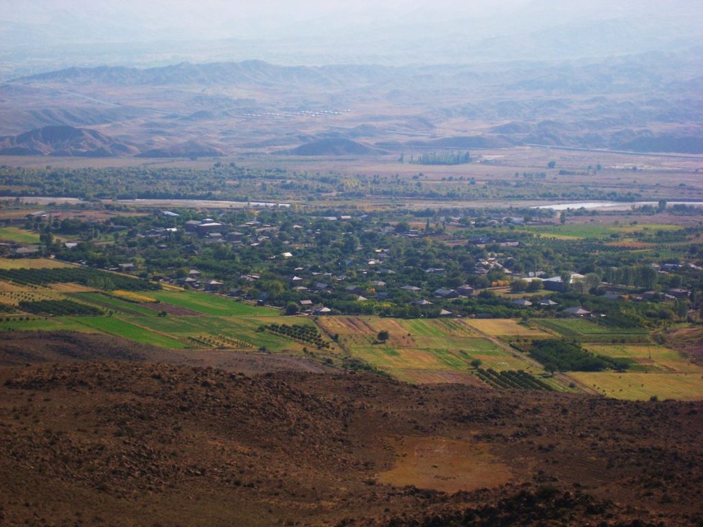
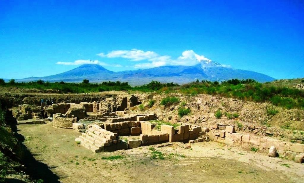
The other capital of Armenia was Armavir. In 1032 BC, Aramayis, the founder of the Hayrikian’s Ayrarat kingdom, built the city. Ruins now are on the left bank of the Yeraskh River, at the altitudes of Haykavan, Armavir and Jrashen villages of Armavir Marz.
On the hill near the village of Haykavan (Armavir Marz), you can see the light blue battlements made of basalt, basements, and traces of palaces, temples and other buildings in Armavir.
Excavations have also revealed a whole complex of rooms built of raw brick. The famous Sosyats Forest was also here.
Armenian historian Khorenatsi attributes Armavir’s foundation to the grandson of Hayk Nahapet(forefather), Aramayis. The cuneiform record of King Argishti in the territory mentions the city of Argishtikhinili.
Argishtikhinili has been built, expanded and renovated for nearly 200 years. It is one of the largest cities of the time, a prominent economic, cultural and spiritual center. The city occupied about 1000 hectares together with the suburbs.
There were about 30,000 people living there. The thickness of the battlements of the city reached 3.5 meters. Also, the total length of Argishti’s canal was about 40 kilometers. The average depth and width were 2 meters each.
So, in short, King of Van (IX-VII centuries BC), Argishti the First, in about 776 BC, built the Argishtikhinil city near Armavir. The city then transformed into the administrative center and the military base of the Northern territories.
In 331 BC, Armavir became the capital of the Yervanduni
Argishtikhinili accreted into Armavir, became the capital of the Yervanduni kingdom in the IV–III centuries, preserving the name Armavir. The city was also the main center of the pagan worship. In addition, it was the residence of the priest.
After moving the royal palace to Yervandashat, Armavir, however, lost its significance. In the bibliography, it was already mentioned as “abandoned capital”. It preserved its existence until the 5th century, after which it was no longer mentioned as a city. Besides Armenian manuscripts, Greek scientist Claudius Ptolemy (90-160) also mentioned Armavir in his works.
Three cuneiform tablets in Elamite language were discovered in Armavir during excavations. They were the fragments of the famous epic “Gilgamesh”. So, historians assume that the performance of the epic took place in Armavir, in 760 BC, during the wedding ceremony of Sardur II and his wife…
It is also possible that the performance is much older. Thus, the theater in Armenia was founded not in Artashat, but in Armavir and continued for centuries. The Greek protocols of Armavir, one of which dates to the 7th century BC and is a fragment of an ancient Greek writer Hesiod’s “Works and Days”, confirms the fact above.
During the reign of the King of Yervandouni kingdom, Yervand the Last, who, according to Khorenatsi, enthroned for about 20 years (220-201 BC), ordered to transfer the capital to Yervandashat.
Armavir became unsettled in the 13th century as a result of Mongol invasions (hence the name “abandoned capital”). Centuries later, Armenians living in the northern Caucasian villages set up a new city and in 1848, the city owned the name Armavir (now in the city of Krasnodar, Russia).
YERVANDASHAT
Following Armavir, the 3rd capital city is Yervandashat (also called Yerevandashat, Marmet). It is the last capital of the Yervanduni Kingdom.
King Yervand the Last (220-201 BC) founded the city on the left bank o
f the Yeraskh River, where the river confluences with Akhuryan.
King Yervand the Last transferred the wealth of the kingdom together with a part of the population of Armavir to Yervandashat.
According to Khorenatsi, the main reason for moving the capital was the change of the flow of Araks river, causing the city’s residents to lose water. The military-political significance was also very important.
King Yervand surrounded the citadel with high battlements, built firm gates (doors) made of copper for the city’s entrances. He even dug deep holes to the bottom of the hill. So deep that it could be possible to use the water of the river in case there was a long-lasting blockade.
Architect Toros Toramanyan also noticed that the magnificent quartz buildings were merged only through iron ties.
Very close to the new capital, on the right bank of Araks River, King Yervand also built the Yervandakert homestead where the royal family resided.
In the 4th century, Persian King Shapur’s troops completely demolished the city. One can find the ruins in the south-west of the current Armavir Marz, between Bagaran and Yervandashat villages. Movses Khorenatsi, in addition, gave us valuable information about Yervandashat.
In 189, Artashes I founded the new capital of Artashat after becoming the king of the Greater Armenia. So, let’s go on to the 4th capital!
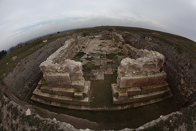
ARTASHAT
Artashat (also: Artaksata, Artashir, etc.) was the capital of Armenia in II BC – IV AD centuries. King Artashes I (189-160 BC) founded the city in the Vostan Armenian province of Ayrarat state, at the confluence of the Yeraskh and Metsamor rivers, 10 km south-west of present-day Artashat, near the Khor Virap monastery.
Plutarchus attributes the choice of the place to Carthage’s world-famous general Hannibal. According to him, Hannibal chose both the place and the city’s plan. Hannibal sheltered Artashes I for a while in his palace.
Taking into account the strong position of the place, the Romans called the city the “Armenian Carthage”.
Roman general Corbulon conquered Artashat in 58 AD. In 59 AD, destroyed and burnt the city. Then, in 66, the city was rebuilt, for which the Emperor of Rome, Nero provided the King Trdat I with material and craftsmen. As a sign of gratitude, in 67 they renamed the city Neronia, but that name was soon forgotten.
It was the largest and the most beautiful place to live
During its flourishing and development period, the city had more than 150 thousand residents.
King Artashes surrounded the city with tremendous battlements. The city, however, kept expanding. People were building many palaces and temples as well as the monument of the goddess Anahit.
The city even had heated baths. The smoke from the fireplace went through the clay pipes to the bathroom floor and walls and heated them.
Interesting to know
TIGRANAKERT
During the reign of Tigran the Great, Armenia became one of the largest powers in the world. The capital Artashat, however, remained in the north of the country.
Tigran, or the King of the Kings, didn’t like the current position of the capital, which was on the outskirts. Therefore, the king built a new capital in Aghdznik in the 80s BC.
Tigranakert was located in the Nprkert province of Aghdznik of Greater Armenia, on the shores of one of Tigris’ rills (now in Diyarbakir, Turkey). The new capital was also the place for Tigran’s coronation.
Over the centuries, various nations have plundered, destroyed the city
VAGHARSHAPAT
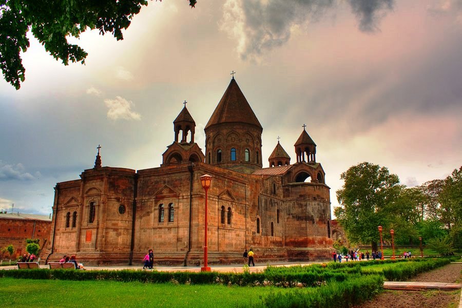
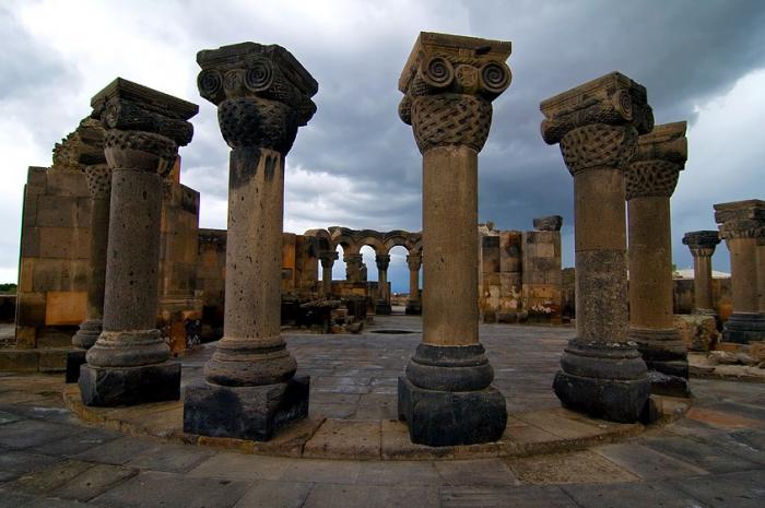
Vagharshapat (also called the Township of Vardges, Etchmiadzin, etc.) is currently 18 km west of Yerevan (now Armavir marz of the Republic of Armenia). The place was a settlement since the Stone Age.
During the reign of Yervand Sakavakiats (570–560 BC), his son-in-law Vardges, founded there Vardgesavan in the IV century BC. When Tigran the Great was the king, the place became a village town.
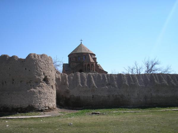
Vagharsh the First Arshakouni (117-140) fenced Vardgesavan, renovated, renamed Vagharshapat and made it the capital. That way, he made it the second royal seat of the king (after Artashat), until the fall of the Armenian Arshakouni dynasty (428).
The town’s citadel occupied approximately the fenced territory of the present-day Echmiadzin monastery.
There was the royal palace, the goddess Anahit temple, the state and public buildings, barracks, the prison, the bathroom, and so on.
The city had battlements with strong towers. Some workshops, the antique temple, and cemeteries remained outside of them. The antique temple was probably dedicated to the sun god Mihr and was in the place of the Hripsime church.
The significance of the city grew especially after the declaration of Christianity as a state religion in Armenia (301 AD). It was when the Armenians founded the Echmiadzin Cathedral (302-303).
The city became the residence of Catholicos of All Armenians (with some interruptions).
After the invention of the Armenian alphabet (405), Mesrop Mashtots returned to Vagharshapat. After which, Mesrop Mashtots and Sahak Partev set up the first Armenian school in the city.
The first Matenadaran was also established here. In 484-486, Vahan Mamikonyan completely renovated St. Echmiadzin monastery, and the monastery’s trustee, historian Ghazar Parpetsi founded the first Armenian Matenadaran, and Vagharshapat became the center of Armenian literature.
Starting from the 13-15th centuries, the city owned the name Etchmiadzin (after the first Christian Armenian Church of the Holy Mother of God, Etchmiadzin).
During the XI century, the invasions of the Turk-Seljuks and then Tatar-Mongols took place. This continued till the XVth century. Vagharshapat lost its significance and its past shine. In 1441, however, after the re-establishment of the Catholicosate of All Armenians in St. Echmiadzin from Sis, the city revived and started ‘breathing’.
In addition to the Mother Cathedral (IV century), churches of Hripsime and Gayane (VII century), there were also the Church of Shoghakat (in 1694, with the funds of Aghamal Shorotetsi) and other buildings.
By the efforts of Catholicos of All Armenians Simeon A. Yerevantsi, in 1771, they built the first printing house of Armenia, and in 1776 the first paper factory in Vagharshapat.
In 1828, after East Armenia joined with Russia, the city became the center of Vagharshapat canton of Yerevan province.
At the end of the XIX century, Vagharshapat became one of the important centers of Armenian culture.
Prominent figures of science and culture Komitas (Soghomon Soghomonyan), Hovhannes Hovhannisyan, Hrachya Acharyan, Manuk Abeghyan, Yeghishe Tadevosyan, Galust Ter-Mkrtchyan, Garegin Hovsepyan and others visited the city.
Under the direction of famous architect Alexander Tamanyan, they formed the city layout in 1925. The area of Vagharshapat (in 1945-1995: Etchmiadzin) expanded. New residential neighborhoods, Zvartnots, South, as well as several areas of low-rise construction have been built.
Today, the city again owns the name Vagharshapat.
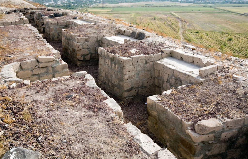
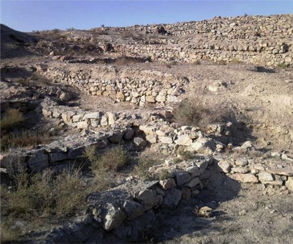
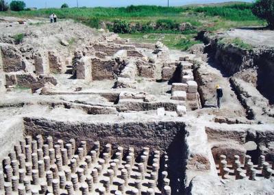
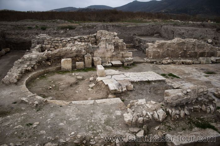
DVIN
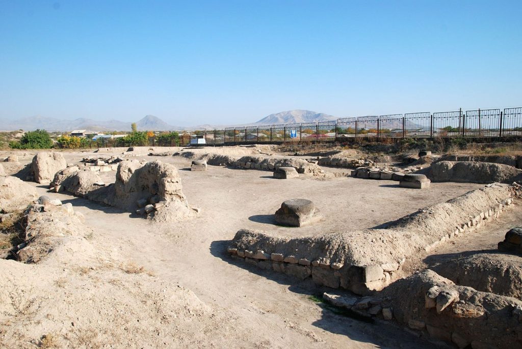
It was one of the largest cities of the time, not far from Artashat. Dvin had various versions of names. In Armenian, Dui, Dvin, the Arabs called Dabil, Adabin, the Greeks – Duvi. Even the Ararat Valley and the Arax River sometimes wore the name “Dvin”.
The territory of Dvin was a settlement since the V millennium BC. There are even traces of cyclopean battlements of 2-1 millenniums BC.
Also, there are the remains and objects of religious buildings of the pre-Christian era. A mausoleum, with fragments of stone statues and sculptures.
Armenian king Khosrov Kotak (332-338) founded Dvin as a royal city in the 30s of the 4th century when he moved the royal seat from Artashat to Dvin, declaring it as the new capital.
Khosrov wanted to improve the climate of the city, as the area was hot and dry. Therefore, he created huge forests and made them a royal hunting place.
Today the forest still exists, and is famous as “Khosrovi Antar” meaning “the Forest of Khosrov”.
Khosrov’s successors have been building the capital for several centuries. During the excavations of the citadel, a large pillared hall with a polished stone was opened. It is supposed that this is the giant hall of the Arshakuni kings, on the floor of which the height over which there was the royal throne is still visible.
After the fall of the Arshakouni dynasty (428 AD), Dvin became the capital of the Marzpanate Armenia in the half of the 5th century.
After Vagharshapat, Dvin became the throne of the Armenian Catholicosate in 484-931. In the VI-VIII centuries many nationwide meetings took place in the city.
In the VII-IX centuries, Dvin was the residence of the caliphate of the Arminia administration, where the Arab policemen had the right to make drams. Their copper and silver coins had Dvin (Dabil) inscriptions. They also spread it in the South Caucasus, the Middle East and elsewhere.
Dvin was one of the largest cities in time
Powerful battlements surrounded the citadel. Around them was the lower fortress. In the territory right between them, there were living high-ranking people, officials and military personnel.
The Lower Fortress parapets were enormous, 12-15 meters thick and 15-20 meters high. There were also solid and strong towers in the four corners of the parapet (battlements).
Also, there were giant pyramids on each 40 meter, in total over 30. Outside the parapets, there was 5-6 meters deep and 30-50 meters (ssometimes65-70 meters) wide moat, which was filled with Azat River water. All the districts of the city received water from the surrounding mountains through the clay tubes.
During its flourishing years, Dvin had more than 150,000 inhabitants. The city was the center of advanced craftsmanship. The earliest evidence of goldsmiths’ mastery of Dvin are the serpent bracelets, chain necklaces, rings, earrings, silver belts, and jugs. Also, ceramics and pottery were so developed that the masters were producing pots with even 1000 liters of capacity.
Over the centuries, various invaders repeatedly destroyed the city. Following the establishment of the Kingdom of Bagratuni in Armenia (885), Dvin lived a new economic upsurge. According to Arabian writers, Dvin produced and exported to foreign countries wool and silk fabrics, rugs, sofas, ceramic items, Vordan Karmir and so on.
The city suffered especially from catastrophes. The worst of them was the earthquake in 893.
After the 1020s, the Muslim Empire ruled Dvin, and in the second half of the XI century, Seljuk Turks captured the city. In 1203, the Zakaryan princes liberated the city and united it with their Shirak’s domains. Jalal ad Din completely destroyed the city during the 1255 invasion.
Now one can find Dvin’s ruins in a number of villages adjacent to Artashat. (Verin Dvin, Nerkin Dvin, Norashen, Berdik and other villages).
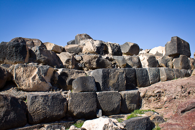
BAGARAN

Bagaran was at the northeastern end of the Arsharunik canton of the Ayrarat province on the right bank of the Akhuryan River (now in Turkey).
According to Movses Khorenatsi, the last representative of the royal dynasty of Yervanduni, Yervand IV built Bagaran in the beginning of the 2nd century BC.
The main complex of pagan temples in Armenia was in Bagaran, near which there was the artificial forest called “Tsnndots”. Then the city lost its former political and social significance.
Bagaran had a citadel with thick parapets around which the city was spread. There were the Bagratuni dynasty palaces and tribal mausoleums, churches, the most famous of which was the St. Theodoros Church.
The ruins of the buildings on the canyon and on the opposite hills as well as the existence of five churches prove that the city was beautifully built and crowded.
In the 9th century, Ashot Bagratuni Msaker bought the Kamsarians’ domains and Bagaran became a ministerial residence.
At the end of IX century, Bagaran was the capital of the newly established state of Bagratuni. Here were the Bagratuni tribal mausoleums, where the founder of the dynasty Ashot the Great (885-890) was buried.
After the collapse of the Bagratuni Kingdom, Seljuk Turks destroyed the city. In 1394, the raiders of Timur destroyed it.
The glory of Bagaran was never restored. At the beginning of the 20th century, it was an ordinary village with 800 inhabitants. The village was destroyed and abandoned during the First World War. In 1918-20 few Bagaran Armenians emigrated and settled on the left ban
k of Araks River, built the present village of Bagaran and lived there.
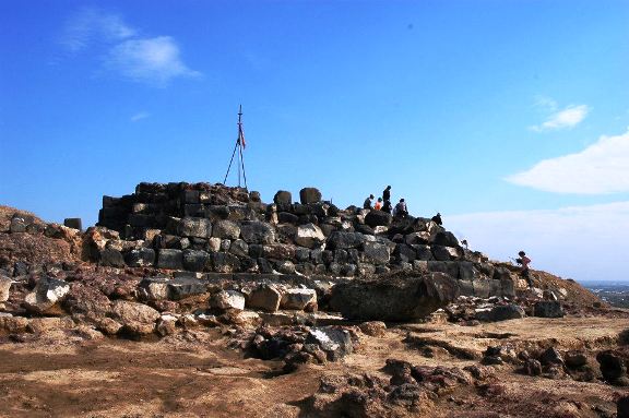
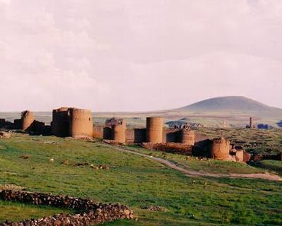
SHIRAKAVAN
Shirakavan originally owned the name “Yerazgavors”, or sometimes “Yerazgavork”. It followed Bagaran, and for about 40 years, during the reign of Smbat I and Ashot II Bagratuni, it was the capital city.
Shirakavan is not far from Ani, on the right bank of Akhuryan. The coronation of Smbat Bagratuni (890-914) took place here in 892, in the new capital of the country. As mentioned above, for over 40 years, Shirakavan has been the capital of Armenia during the reign of Smbat I and his son Ashot.
In the period of Turkish domination, they distorted the name Shirakavan. Shoragyal became the new name (In the story of “The Gel(Wolf)” by Hovhannes Tumanyan, he mentions the city as Shoragyal).
Being north-east of the city of Ani, now Shirakavan is at the place of the village of Bash Shoragyal in Turkey.
In the VII century, they mention Shirakavan as a village, in the middle of the 9th century, a village town. After becoming a royal residence, it turned into a city.
Shirakavan had its fortress with defensive battlements surrounding it. Historians suppose that during invasions of Turk-Seljuks in 1064, the enemies destroyed Shirakavan together with Ani.
During the reign of the Bagratunis, there was the famous castle of Tignis, which later became an important base of Ani’s defense.
At the beginning of the 20th century, it was a large Armenian settlement. On the eve of World War I (1914-18), there were 1220 inhabitants. After transferring Kars region to Turkey, the Armenian population of Bash Shoragyal moved to Soviet Armenia. Some of them settled in today’s village of Yerazagvors in Shirak province.
KARS
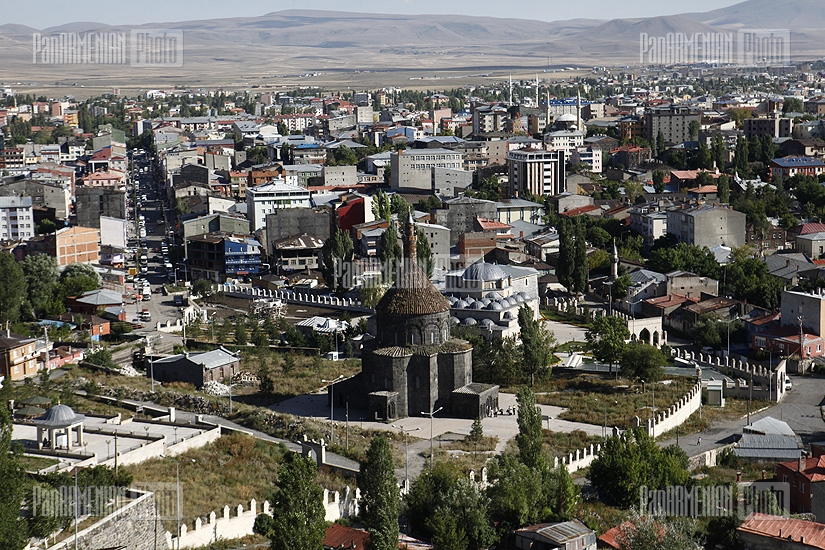

Kars (also: Karutsberd, Karuts, Vanand, Ghars, etc.) is on the right bank of Akhuryan River (the rill of Kars), 1850 meters above sea level.
Since ancient times, it was the residence of the ministerial house of Vanand. The Bagratunis, however, took away the domains of the rebellious prince of Kars. This included the royal seat of Kars as well.
After the death of Ashot II of Armenia (914-928), King Abas (928-953), who was the governor of Kars, did not move to Shirakavan, but remained in Kars, making it the capital.
Royal palaces and other buildings were in the citadel. Abas also built the St. Church of Apostles on the shore of Karsaget. When Ashot III the Merciful (953-977) moved the capital in 961 to Ani, his brother Mushegh Bagratuni, proclaimed himself as the king of Kars.
The fall of the Kingdom dates back to 1065. During the reign of Mushegh’s successor and son, Abas (984-1029), Kars became economically powerful. However, from the second half of the XI century to the end of the XII century, Seljuk Turks dominated the city.
The constant invasions of Seljuk Turks forced Gagik Karsetsi king to surrender the city and surrounding areas to Byzantium and move to Cappadocia.
By the Turkish-Persian Treaty of 1639, Kars passed to Turkey. Until 1670, it was the episcopal seat of Vanand.
The invasions continued
Kars was a large crafts and trade center, with a strong and solid fortress that was destroyed in 1877-78 during the Russian-Turkish war. On November 6, 1877, the Russian army, with its leader General Hovhannes Lazarev, conquered Kars, made it a new administrative unit of the Russian Empire.
On April 25, 1918, the Transcaucasian Seim handed Kars to the Turks without a fight, although the city had a well-armed garrison.
In May 1919 the city passed to the first Republic of Armenia (1918-20). In a short period of time, many Armenians returned there. On October 30, 1920, however, the Kemal forces again invaded Kars and slaughtered 8 thousand Armenians.
Under the Moscow Treaty on March 16, 1921, Kars was surrendered to Turkey. As of 2010, Kars is a provincial town with a 65 thousand population (mostly Kurds and Turks). It is the administrative center of Turkey’s vilayet of Kars.
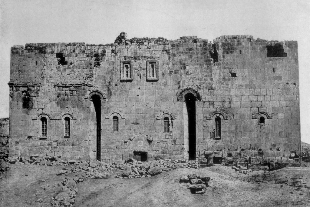
The most valuable historical and architectural monument of Kars is the Mother Church (X century). A number of Armenian cultural and scientific figures were born in Kars, including poet Yeghishe Charents.
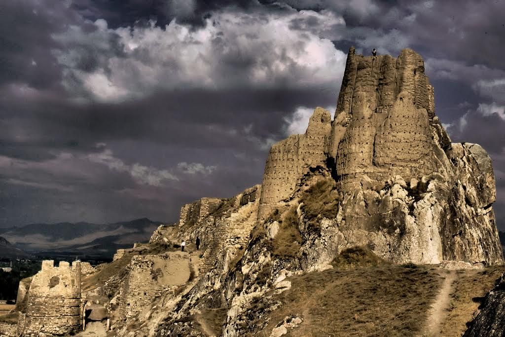
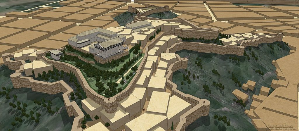
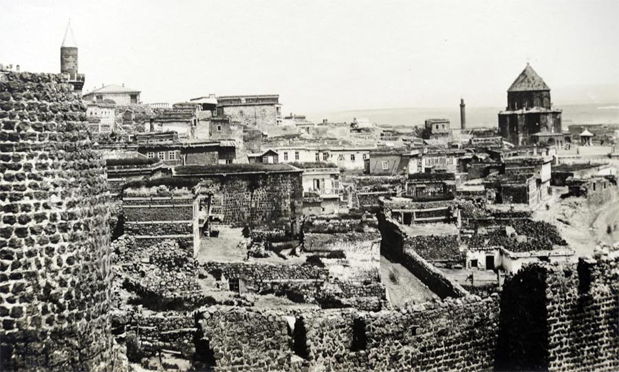
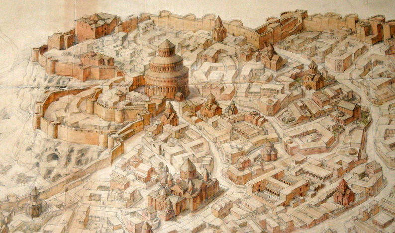
ANI
Ani is located in Shirak on the right bank of Akhuryan. The area was a settlement since the ancient times, with evidence of the remains of cyclopean buildings.
The hill, where stood the town’s citadel later, was fenced still during the Kamsarakans period (4th century). There was also their prince residence. The Kamsarakans after the rebellion against the Arabs (773-75) moved to Byzantium, and their territories passed to the Bagratouni dynasty.
In 961, the coronation of Ashot III the Merciful took place in Ani and he made the city his residence, and the capital.
Just 2-3 years after the proclamation of Ani as the capital, the king built the inner battlement of Ani. People assume that during his reign, the water pipeline was built and the palace of the Kamsarakans was reconstructed.
Ani was being constructed with unusual speed
Next, King Smbat II encloses the expanded city with a new row of battlements, about two and a half kilometers long and 8-10 meters high. On the outer side, there was a deep pit about 500 meters long and 10-12 meters wide. It was filled with water. Other than defensive purpose, it served also for agricultural purposes.
Ani’s defense system included the citadel, the Aghjkaberd, other fortifications, and suburbs. The battlements of Ani had 80-90 pyramids, in which there were barracks and guardhouses.
The coat of arms of Ani, the running leopard, was depicted on the Main Gate. The bridges also played an important role for the defense. Only on Akhuryan alone, there were ten bridges – portable and double-fortified on both sides.
Besides this, there was also nether-world Ani, which had a military, defensive significance. Its halls and caches, hollows and cavities were amazing hiding places and traps.
The houses were usually one and a half story, or two-story consisting of 3-6 residential and auxiliary rooms. The main street was 4-5 meters wide and there were stone benches on the sidewalks. Also, the main line of the city’s water supply passed through that area. The Ani water supply system was a very complex one for the Middle Ages, with clay and iron pipes. They supplied the 6 Ani baths with water.
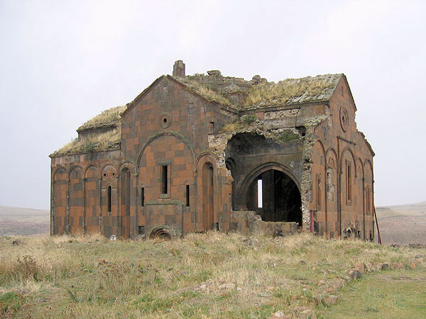
Ani had a lot of churches
According to historians, there were a thousand and one churches, the masterpiece out of which was the Mother Cathedral with Trdat’s architecture.
Ani was an important link in international trade routes. There were 10-15 hotels in Ani to give shelters to the foreigners. The city was famous for its diverse crafts, including glasswork. They made cups, vases, glasses, crystal items. The city, in addition, had several markets.
In Ani, there were also Matenadarans – in the palace, in the high school, at the Catholicosate, in the monasteries. The theater also had a special building.
The wide suburbs, hundreds of churches, and a rather dense construction prove that Ani had a great amount of population. According to historians, there were more than 100,000 residents in the city.
After the fall of the Bagratouni kingdom, Ani’s glory began to gradually fade away. In the 16th century, Ani was mentioned as a village.
In 1236, the Mongols invaded Ani. They cruelly suppressed the rebellions of Ani people in 1249 and 1260s. In the XIII-XIV centuries, because of the pressure and heavy taxes of the Mongols, and later the Turkish tribes, Ani people had to migrate to Georgia, Southern Russia (Astrakhan, Crimea). They later moved to Constantinople, Galicia, and Poland.
In the 60’s of the XIV century, the Mongol-Tatar tribes destroyed Ani, which became a complete desert in the XVI-XVIII centuries. In 1878, Ani passed to Russia, in 1920 – to Turkey.
Now it is one of Turkey’s “sights”.
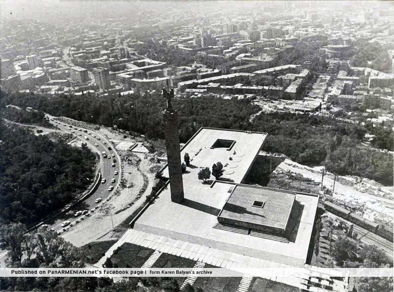
YEREVAN
In the 9th century BC, in the Armenian Highlands, on the shores of Lake Van, the Armenian Kingdom of Van appeared. It is also called Urartu, Biainili or just Araratian kingdom. The founder of the kingdom was King Arame. The Van Kingdom was one of the most developed states of its time.
King Argishti I was the 5th King of Van. In 782 BC, during the 5th year of his reign, he founded Erebuni fortress-city or today’s Yerevan. It became one of the most important cities in the country. The date of the Erebuni establishment is well-known from the cuneiform record of King Argishti.
The record shows that 782 BC is the birth date of the city. Erebuni-Yerevan was also founded 29 years before Rome. It has the same age as Babylon.
Throughout the centuries, Yerevan has survived a lot of calamities and trials. Innumerable attacks of enemies such as the Assyrians, Romans, Byzantines, Persians, Arabs, Seljuks, Mongols, and also Turks took place, yet Yerevan courageously resisted all the trials.
When the Ottomans recognized their defeat and then left the WWI, the borders of Armenia were restored, which included the entire state of Yerevan.
The administrative-political bodies also moved to Yerevan. Hundreds of Armenians, from both Eastern and from Western Armenia started to live in Yerevan. Some of them were refugees. Yerevan State University was opened in 1919. Many Diaspora Armenians began to express their willingness to invest in newly independent Armenia.
Besides being the political and administrative center of Armenia, Yerevan is also the main economic and cultural center. About 30% of the population of Armenia lives in Yerevan. Up to 98% of higher education and research institutions, also the overwhelming majority of banks and stock exchanges are concentrated in Yerevan.
Read more detailed about Yerevan here.


Leave a Comment