Aragatsotn province is one of the 11 administrative divisions (also marz or մարզ) of Armenia. The capital town of the province is Ashtarak. The Aragatsotn province occupies an average place among the provinces of Armenia by its size, and the number of the population it exceeds only the Vayots Dzor and Tavush provinces. The Aragatsotn province has inherited its name on behalf of Aragatsotn region from the historical Ayrarat province.
|
OVERVIEW OF ARAGATSOTN PROVINCE |
|
| COUNTRY | Armenia |
| CAPITAL | Ashtarak |
| GOVERNOR | Gagik Gyozalyan |
| TOTAL AREA | 2,756 km2 (1,064 sq mi) |
| POPULATION | 132,925 |
| TIME ZONE | AMT (UTC+04) |
| POSTAL CODE | 0201-0514 |
| WEBSITE | http://aragatsotn.mtad.am |
 |
|
GEOGRAPHICAL DESCRIPTION

Peaks of Aragats
NATURAL CONDITIONS OF THE PROVINCE

NATURAL RESOURCES
RIVERS & LAKES

-
Akhurian River (Akhuriyan, Akhuryan, Akhouryan )
Akhouryan river originates in Armenia and flows to the Turkish border.
-
Kasakh River
The length of Kasakh is 89 km. The source of Kasagh is two small rivers, one of which starts from Aragats, and the other is from Pambak mountains. So, both of them are mostly flowing through flat meadows and then joining each other. However, the water of Kasah is almost completely used to irrigate the surrounding villages. That is why in the summer months, during the strongest evaporation of water, Kasakh river become dry. Aparan reservoir was built on Kasakh.
-
Lake Kari (Lake Qari)
This lake is on the slopes of Aragats, and it is mostly formed by ice and snow. The height is 3207 m above the sea level, the surface area is 0.12 km². From Byurakan to Lake Car, there is a lane road, and on the eastern shore, there is a meteorological station.
-
Lake Lessing
One of the few natural lakes in Armenia and it also lies on the slopes of Aragats.
MOUNT ARAGATS
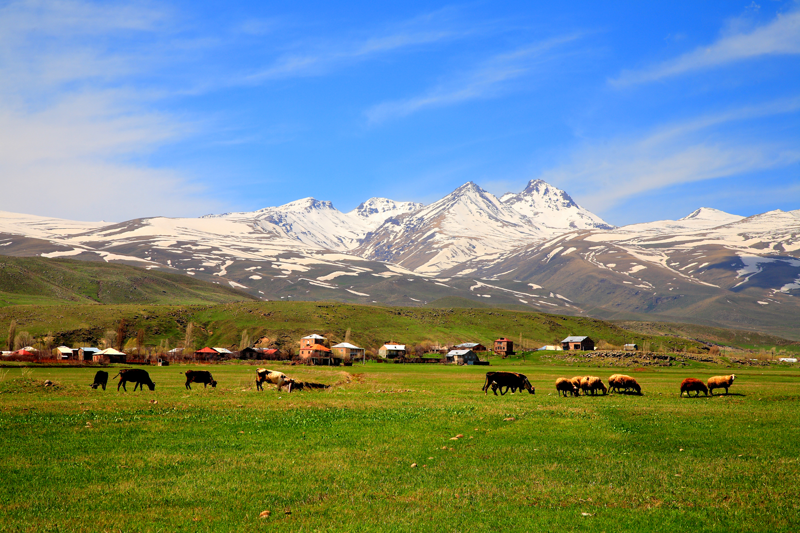
Aragats mount is the highest point of the Armenia. The height is 4,090 m (13,420 ft) above sea level. It is surrounded by Ararat plain (south), Shirak plain (north), Kasakh River (east), and Akhurian River (west). It has four summits, and according to their geographic position, they have the following hights:
- Northern—4,090 m (13,420 ft)
- Western—3,995 m (13,107 ft)
- Eastern—3,908 m (12,822 ft)
- Southern—3,888 m (12,756 ft)
-
LEGENDS
According to the legend, Armenian mountains were brave and gigantic bothers. Waking up early in the morning, they, first of all, tied their belts and then just greeting each other. So, time passes. The brothers were old and begun to get up late. One day they forgot to tie the belts first and greet each other. When God saw that and punished the brothers. They turned into mountains. Today, the belts are green fields, and tears of brothers are immortal waters. These four mountains are Aragats, Greater Masis, Sebelan, and Sipan.Other legend told, that Masis and Aragats were very good sisters. One day, they started to fight. So, one of them said: “I am better, higher,” and another one: “No, I am higher and more beautiful and of course more attractive.“The Mount Marout tried to reconcile the sisters but he was unable to re-establish peace. So, he started to curse them: “Let Masis and Aragats separate from each other so that they will never meet.” Correspondingly, in their turns, Masis and Aragats were also cursing each other. It happened! Currently, the mountains are separated politically.
-
DANCE OF UNITY AROUND THE MOUNTAIN (On May 28, 2005)
Around 250,000 people participated in a Dance of Unity around Mount Aragats. They demonstrated the unity of our nation and celebrated the anniversary of the First Republic of Armenia. However, among the quarter million participants was also the President Robert Kocharyan.

LANDMARKS & ATTRACTIONS OF THE PROVINCE
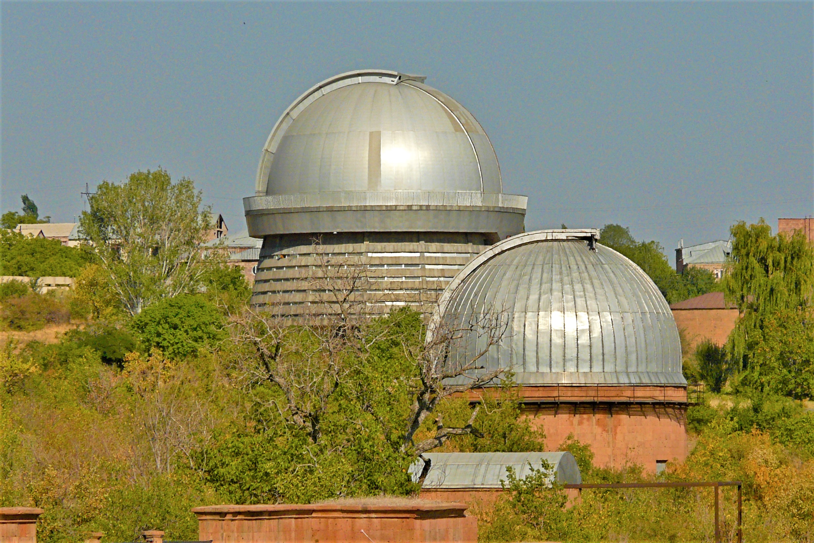
- Byurakan Observatory after Viktor Hambardzumyan is an observatory at the Byurakan village of Armenia, on the slope of Mount Aragats. However, it belongs to the Armenian Academy of Sciences. Of course, it is one of the most important observatories in Eastern Europe and the Middle East. Founded in 1946 by academician Victor Hambardzumyan, he was the first director of the observatory. So, the architect is Samvel Safaryan.

- In the village of Oshakan, near the regional center, there is a grave of St. Mesrop Mashtots, the creator of the Armenian alphabet.
- The park of Armenian alphabet or Alphabet Park is near the village of Artashavan. It was founded in 2005, and it is dedicated to the 1600th anniversary of the invention of the Armenian alphabet. In addition, the monument includes the ornaments of 39 letters of the Armenian alphabet and the monuments of the Armenian elders, such as Mesrop Mashtots, Hovhannes Tumanyan, Khachatur Abovian, and others.

“Gregory the Illuminator”
“Writing Creation, 405”
“Movses Xorenaci”
“Mkhitar Gosh, Judgment Book” (sculptor Samvel Hakobyan)
“Anania Shirakatsi” is the symbol of the earth and the universe
“Khachatur Abovyan”,
“Tumanyan and his hero Gikor”
- Hovhannavank monastery located in the village of Ohanavan, on the right edge of the gorge of the Kasagh River.
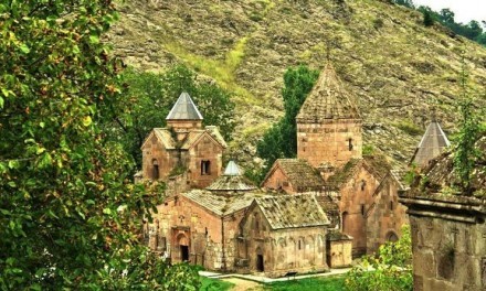
- So, there are many medieval buildings throughout the region. Especially the following churches and monasteries are popular: Amberd, Talin, Saghmosavan, Ashtarak’s churches etc.
CHURCHES & MONASTERIES
- Tomb of the Arshakid Kings or Arshakuni mausoleum is a mausoleum in the center of the village of Aghtsk (Dzorap) of Aragatsotn Province. In addition, this mausoleum remains of both Christian and pagan kings of the Arshakid dynasty of Armenia.

- The Kasagh Basilica or Holy Cross Church is another early medieval Armenian church. So, it is in the town of Aparan.

- The Church of Surb Hovanes/Saint John/ or Mastara Church is in town Mastara. It comes from the 5th century. In addition, this complex church is very similar to St. Hripsime Church, Echmiadzin.
- The Saint George or Surp Gevork church is in the center of the village of Garnahovit.
- The Church of Aruch, Aruchavank or the Cathedral of Aruch is in the village of Aruch. In addition, it is one of the largest and architecturally one of the most important Armenian churches of the Middle Ages.
- Saint Christopher Monastery comes from the 7th century. So, it is near to Dashtadem village and Dashtadem Fortress.
- Artavazik Church of the 7th century is near to the village of Byurakan.
- The Cathedral of Talin of the 7th century is in the town of Talin.
- Surp Hovhannes or Voskevaz Church is a 7th- to 12th-century located in the village of Voskevaz.
- Saint Sarkis Monastery, also Surp Sarkis Vank is one of the largest monastic complexes, 45 by 54 meters (148 by 177 ft) near to the village of Ushi.
- The Surb Astvatsatsin Church, also Yeghipatrush Church is in the village of Yeghipatrush. It comes from the 10th and 13th centuries.
- Surp Hovhannes Church is an important basilica of the 10th century. So, it is in the village of Byurakan.
- The Vahramashen Church or Vahramashen Surp Astvatsatsin Church of Amberd is near to the fortress of Amberd. In addition, this building belongs to the family of Pahlavuni and Prince Vahram Pahlavuni built it.

CHURCHES & MONASTERIES
- The Tukh Manuk Shrine of Oshakan is in the town of Oshakan.
- Tegher Monastery is an Armenian monastery and church from the early 13th-century. So, it is near the modern village of Tegher.
- The Saghmosavank is one of the popular and of course favorite monastic complexes of 13th-century. It is in the village of Saghmosavan.
- Saint Mesrop Mashtots Cathedral is a 19th-century church, built between 1875 and 1879. So, it is in the Oshakan village.
- The church of Surp Astvatsatsin is in the village of Karbi and it comes from the years of 1691-1693.
- Saint Gevork Monastery or Saint George’s Monastery is in the village of Mughni.
- The churches of St Grigor (13th–14th centuries) and St. Gevork (19th century) are in village Kosh.
- In addition, there are also the churches of Spitakavor, Karmravor, Tsiranavor, Saint Mariane and Saint Sarkis in Ashtarak.
In conclusion, there are many reasons why you should visit this province to discover more historical places. You can take several days to travel around it all.




Leave a Comment