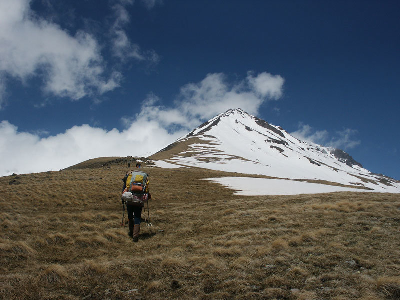
Mount Aragats
Geography
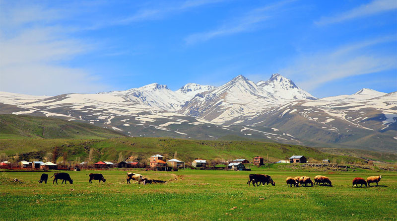
Mount Aragats is the highest mountain of Armenia. And it’s the fourth in Armenian Highland. It was in the borders of Aragatsotn, Shirak and Nig provinces of the Kingdom of Greater Armenia. Now it is in the area of Aragatsotn and Shirak regions and has a central position.
Aragatsotn mountain has four edges. The highest is northern by 4090 meters, then the Northwestern by 4080 meters, eastern by 3916 meters and the southern edge by 3897. The length of its base’s borders is 200 km. Among the edges, there is its crater with 350 m depth and 3km width. It is connected to the surroundings by the erosion aperture of the north, southern part.
Aragats has some big valleys – Gegharot, Amberd, Mantash and so on. The snow melting, rain-water, and channels create many rivers. There are also lakes on Aragats that attract everyone with their beauty.
In Aragats half-deserted, dry land-deserted, alpine and snowy zones follow one another.
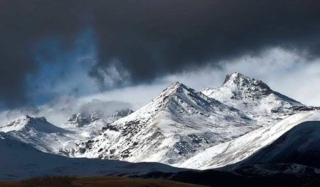
Mount Aragats
The climate of Aragats changes according to the height. From the lowest part to the top, the annual temperature fluctuates from -3°C to +10°C. In the slopes the temperature is mild, in winter it’s cold.
The massif is rich with its haymakings and pastures. The meadows are full of fragrant flowers: violet, lily, poppy, Bellflower and many other beautiful flowers.
The wildlife representatives of Aragats are the Armenian Jerboa, rabbit, fox, wolf, lizards, turtles and snakes, also many birds.
The volcanic lavas cover the massif.
The Rivers
Kasagh
Kasagh is a lake with 89 km length. The surface of its basin is 1482 km2.
The outfalls of Kasagh are two little rivers. One of them starts from Aragats and another one from Pambak’s land slopes. They both mainly leak along smooth meadows and then connecting with each other create Kasagh river.
Geography
On the upper stream Kasagh flows more slowly and is low-watered, and on the middle stream becomes abounded in water and swift. Here, especially in the areas of Ashtarak and Oshakan villages, it flows through a deep canyon. At the estuary, it is divided into some parts and is poured into Sev water. In the lower stream in the area of Araratyan field, to irrigate the surrounding villages and gardens, people almost completely use the water of Kasagh river. That is the reason that in summer Kasagh parches completely.
Kasagh has 89km length. Amberd is the most abundant in water of the brooks of it. It starts from the redundant sources of Aragats and the water of the melted snow. For controlling the regime of Amberd, the snow that was brought by winds and gathered in the deep canyons has an important role. It usually melts under the sun and by that always provides water to the channel. Amberd streams by a deep canyon. It sometimes overflows and sometimes lowers. The reason of this is downfalls, that happen in Aragats.
The water of Kasagh falls and stays in Aparan’s pond. People use it for irrigation.
Gegharot
Gegharot is the right brook of Kasagh. It starts from the right slope of Aragats, from 3600 height. The length is 25km; water catchment basin is 66km2. The valley of the river is V-shaped and like a canyon. Its nourishing is mainly from melted snow and overflows in May-June. In winter it freezes. The waters people use for irrigation.
Amberd
This river is the right brook of Kasagh. Amberd is a river in Aragatsotn province. It starts from the southern slope of Aragats, at an altitude of 3700 meters. The length is 36 km, the fishing basin 141 km2.
Its nutrition is mainly snowy and rainy and nether, the overflowing is at the end of spring and at the beginning of summer.
Mantash is in the Shirak province. Starts from the northwestern slope of Aragats. The overflowing is in May-June.
Tsaghkahovit has 20 km length. Starts from the northern slope of Aragats and in the southwestern part of Vardablur intermixes with the main river.
Geghadzor joining to Mantash creates Karkachan.
The waters are for irrigation.
Tradition about Aragats
The tradition says that before mountains of Armenia were giant brothers. Every morning, when they woke up, they used to fasten their belts then greet each other. Many years passed and the brothers were already old. They woke up later than they used to do.
One day, waking up, they forgot to fasten their belts before greeting each other. God, seeing this, punished the brothers. They couldn’t move and became mountains, the belts green fields and the tears of the brother’s immortal sources.
Among those mountains were Aragats, that was the highest mountain in Armenia.
Byurakan Observatory
Byurakan Observatory named after Viktor Hambardzumyan is in Byurakan Village, in the slope of Aragats. Armenian National Academy of Sciences has the ownership and disposes of it. It is one of the most important observatories of Eastern Europe and the Middle East.
It has two parts: residential village and operational part, which includes the towers, administrative and laboratory buildings, meeting hall and guest house.
So if you like observing the stars you should visit here at least one time in your life.
So, if one decides to visit this magical place and see it by his/her own eyes there is a kind suggestion to explore it. As Armenia has many fascinating places to visit it is no wonder that around Mount Aragats there are some cities having interesting past and present to know.
Ashtarak
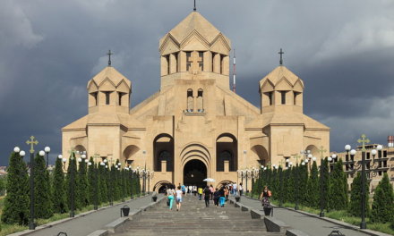
This is the city lying on the shore of Kasakh river, on the centre of Ararat Plain and Aragats massif. It’s 13 km far from Yerevan. In 2015, according to the census, the population of the town was 18500. Only Armenians lived here. Saghmosavan, Nazrvan and Shorshor sources provide drinking water to the town.
Ashtarak is on the northern main road. From Yerevan to Gyumri and Vanadzor people can go through Ashtarak. Moreover, from these cities, people can to one of most interesting places for tourists: Haghpat and Sanahin Monasteries and on the border of Georgia.
Besides, there are very popular historical places near Ashtarak: Oshakan and Amberd, Hovhannavank and Saghmosavank. Valuable places like them are very important for Armenia as many tourists visit there to see Armenian culture and art.
As for St Mariane and Karmravor churches they have a good location as people can reach there easily. Having a simple architectural style they contain a calm energy in them. Metaks road monuments have a special place. For family entertainment and cognitive visits to Tsaghkadzor, many people prefer to go Ashtarak Canyon, Proshyan museum and to see historical monuments. It is worth mentioning “Ashtarak Historical Triangle”.
Aparan
The next town that is worth visiting is Aparan. It is in the Aragatsotn province. Aparan is far from Yerevan by 59km. Before it had different names. Ptolemy was the first who first mentioned the name- Casala, which refers to Kasagh ( Aparan).
Kasakh was the centre of Nig province of historical Armenia. Kasagh bazilik is still standing. In the 10th century, Kasagh was called Aparan. This name means “palace” in the Armenian language.
Till 1995 it was an urban-type settlement, after administrative reform in 1995 it became a city. In 1918 residents of Aparan had a battle against Turk invaders who were coming from Aleksandropol. Every year on May 28 everyone celebrates the victory of Bash Aparan defence.
Talin
The city is 68km far from Yerevan. Before it was the centre of Talin province.In 1964 it became an urban-type settlement and after administrative reform, in 1995 it became a city. Till 2002 the head of the town was Gurgen Grigoryan.
In the early ages, it was a part of Ayrarat. According to the archaeological excavations, Talin had residents in the 2nd decade BC.
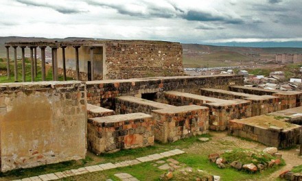
Since 7th century it is mentioned either a village or a city. St Astvatsatsin or Little church is in the city, that was established in 689.
Talin is on the southern part of Aratgats, near to Arteni mountain. The climate is mild. In winters it is cold and in the summers warm. The medium temperature of July is 23-25, of January – 5,-4. And, if one wants to visit there he/she should consider the season.
The industry has a very important role in the economy. There are factories of different fields in the city. One of the factories manufactures natural diamond. The food industry is also developed. Chanakh cheese, that has unique taste comes from Talin. Cattle breeding is the main part of agriculture.
For the irrigation, people use Talin channel.
The most important issues in the area are the full usage of work resources, the repairing of drinking and irrigation water lines, the lighting of the streets, providing gas.


Leave a Comment