Armenia being a small country located in South Caucasus might not take the top places in your Travel wish list. However, it has a lot to offer for its adventurous travelers.
The question “Where is Armenia?” will arise in your head, especially if you had never heard about the country before.
This article will give you a thorough information about Armenia and its location. Hopefully, we can answer all the questions that might occur in your head through the article. So, take a seat for a good read!
Before talking about the current location, let’s go back to the past…
HISTORY AND THE HISTORICAL LOCATION
Armenia is one of the oldest and ancient countries in the world. The Ancient Armenia was one of the biggest countries in the Middle East. If we go back to the 5th century, we can find Armenia’s name illustrated on a Babylonian map, among six other great countries.
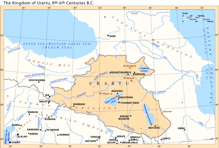
During the 9th century B.C, in the territory of Armenian Highlands, one of the greatest and the oldest states in the Old East appeared. Its name, as known from Assyrian inscriptions, was Urartu. Urartians called their country “Biainili”, in the Bible it is
“The Kingdom of Ararat”. It is also called “The Kingdom of Van.”
Urartu existed till the beginning of the 6th century. Over 300
years of existence, Urartu created a very rich civilization.
The Greater Armenia
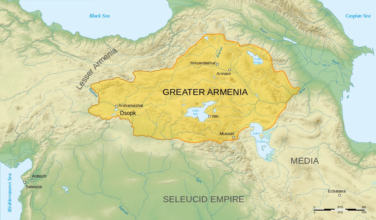
Under the rule of Tigran the Great (95–55 B.C) the Armenian empire reached its peak of power and became one of the strongest and most powerful in Asia. It stretched from the Caspian Sea to the Mediterranean. At that time, the area was called “Greater Armenia” by the Romans. Other territories where Armenians populated was called “Lesser Armenia”.
Three dynasties ruled the Greater Armenia successfully.
- The Yervandouni;
- The Artashesyan (Artaxiad);
- The Arshakouni (Arsacid), the last emperor of which abdicated the throne in 428 AD.
The Greater Armenia covered more than 260,000 km2, and today, the Republic of Armenia covers only the 10% of it, about 29,8 km2.
The Armenian territory once included the Ararat Mountain, which according to the Bible is where Noah’s ark rested on after the big flood. Armenia was also the first country in the world to officially adopt Christianity as its religion in 301 A.D.
Armenia is a mountainous, rocky and also a landlocked country, located on the southeastern border of Europe. Armenian highlands connected the East and the West.
This favorable geographical position was the reason why through the centuries and its long history, various empires and foreign forces invaded Armenia. Greeks, Romans, Byzantines, Persians, Mongols, Ottoman Turks, Arabs, and also Russians conquered it in the old times.
From the 16th century, during the World War I, Ottoman Turks, the main enemy, and the most fierce invaders had major parts of Armenia under control. Armenia was thought to be suspicious by the Turks since many of them were part of the Russian army.
During that times, Armenian people experienced unfairness, inequity, discrimination, heavy taxation, religious abuse, and armed attacks.
The Turks massacred thousands of Armenians between 1894 and 1896.
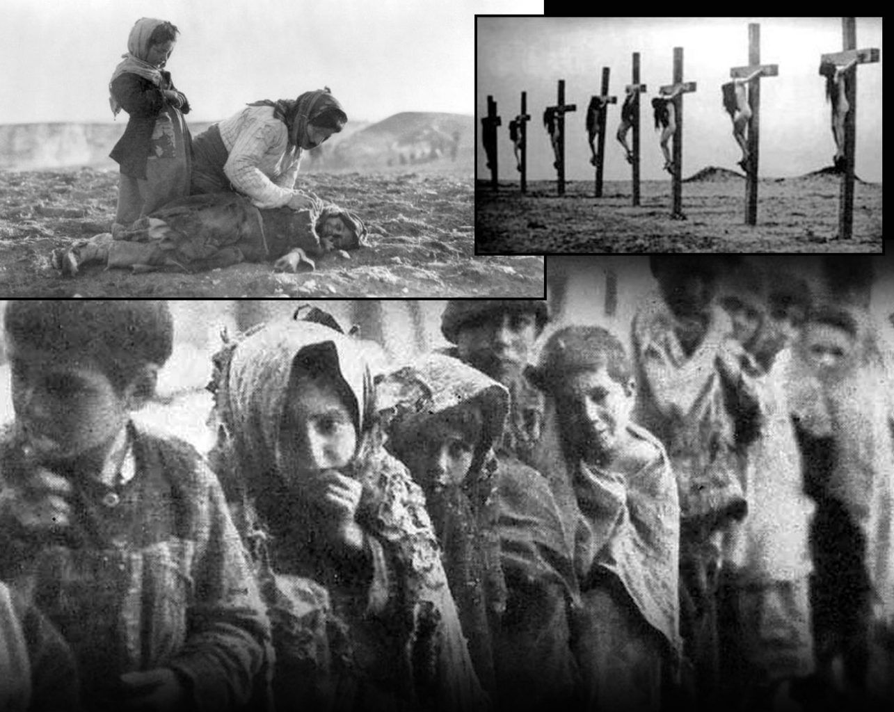
The most dreadful and nightmarish massacre, however, took place during the World War I, in April 1915.
The Turks murdered about 1.5 million Armenians. They were either killed in various horrifying or shocking ways or died of starvation. It is the first genocide of the 20th century.
As the World War I ended, Russia started gaining control of Armenia. Fortunately, much of the destructions and havoc of World War II during the 1940s disappeared.
Decades passed but the tensed relationships between Armenia and Soviet Azerbaijan grew because of Nagorno-Karabakh. In 1970, nearly half a million Armenian people lived in Azerbaijan territory. People from Karabakh craved unification with Armenia.
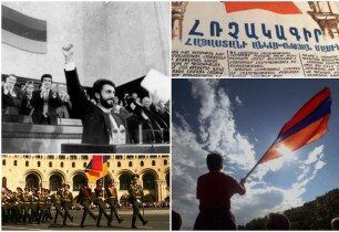
Armenia gained independence in 1991. Before that, for over 70 years, Armenia (Armenian SSR) has been a part of the Soviet Union.
After becoming an independent state and creating the third Republic of Armenia, the country achieved international recognition. Many states started to establish political relationships with Armenia.
Just like the times when Armenians established the First Republic of Armenia in 1918, this time Armenia faced many challenges too. So, the whole independence gaining process was very hard.
For instance, after the Spitak Earthquake occurred, which damaged much of the country’s infrastructure, numerous problems and issues appeared. Armenians also had to overcome the current economic crisis, which happened because Azerbaijan and Turkey closed their borders with Armenia during the Nagorno-Karabakh War with Azerbaijan.
The genocide, the invasions, foreign forces and many other problems and factors had a great influence on the Armenian territory, culture, politics, mentality and its current location.
So, where is Armenia now?
Armenia is an independent country in the South Caucasus. It lies between the Caucasus and Asia Minor, in the northeastern region of the Armenian plateau.
Armenia is a mountainous country in the Alps-Himalayan system of the mountains. It occupies the eastern and the northern parts of the Armenian Highlands.
Being a landlocked country, Armenia is where Europe, Asia, and the Middle East meet. So, culturally and geographically Armenia is a crossroad between them. And thanks to its valuable geographical location, Armenia has always been in the middle of East-West trade routes (Silk Road). This may be the reason why Armenian culture is so rich, diverse and includes both European and Asian spirit.
If we go back to the past, we will see that Armenia was associated mostly with Asia and The Middle East. Presently, Armenia doesn’t have an exit to the sea.
It is interesting and important to mention that Armenian people generally don’t think that their country is a part of Europe or Asia.
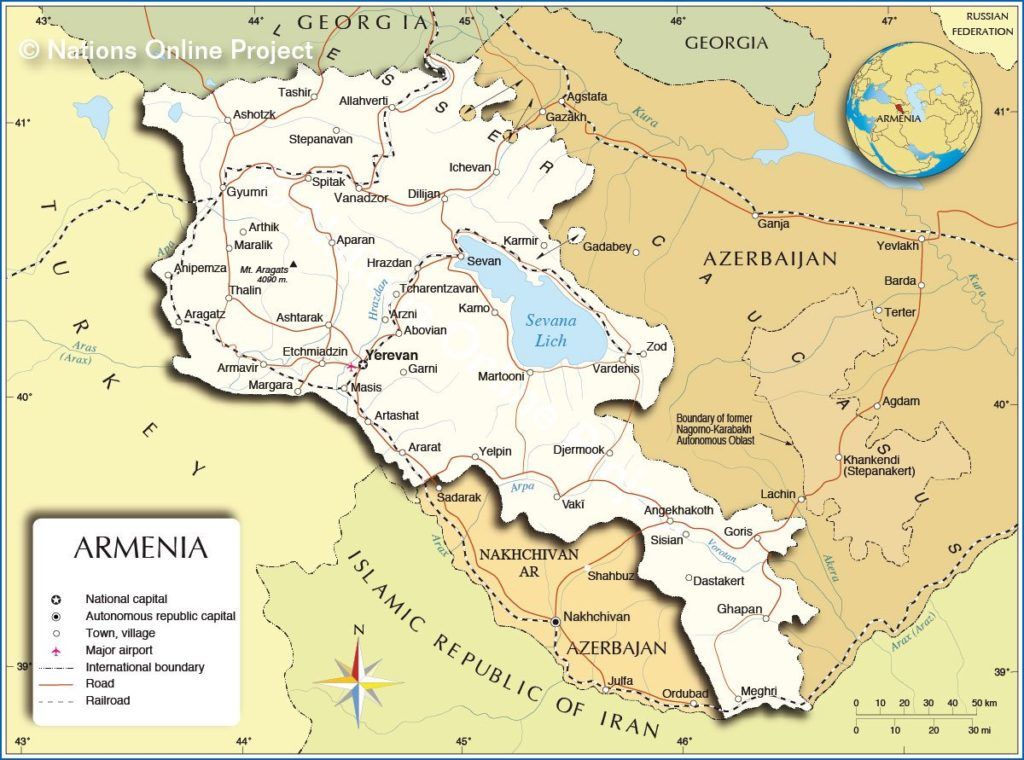
The Republic of Armenia, which was a former republic of the Soviet Union shares borders with Georgia on the north, Nagorno-Karabakh Republic, Azerbaijan on the east, Iran on the south and Turkey on the west.
Here is a small table introducing the information above:
| Country | Region | Border lengths | Border state |
| Georgia | North | 164 km | Open |
| Turkey | West | 268 km | Close |
| Azerbaijan | East | 787 km | Close |
| Iran | South | 35 km | Open |
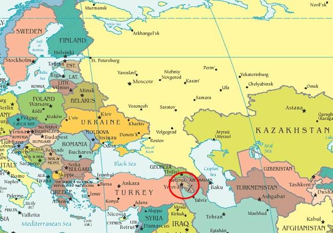
It will be easy for one to find where is Armenia on the map if one knows where its neighbor states are.
Today, the territory of Armenia is just one tenth of its historical lands. Out of 15 historical provinces, Armenia is located only on the territory of 3. It covers 28,203 km2 of land and 1,540 km2 of water. Altogether, the total area is 29,743 km2. Armenia is the 144th biggest nation in the world.
Administrative divisions
There are 11 administrative divisions in Armenia. They are also called “Marz” which means “province”.
| Province/Marz | The capital |
| 1. Aragatsotn | Ashtarak |
| 2. Ararat | Artashat |
| 3. Armavir | Armavir/Hoktemberyan |
| 4. Gegharkunik | Gavar |
| 5. Kotayk | Hrazdan |
| 6. Lori | Vanadzor |
| 7. Shirak | Gyumri |
| 8. Syunik | Kapan |
| 9. Tavush | Ijevan |
| 10. Vayots Dzor | Yeghegnadzor |
| 11. Yerevan* |
*Yerevan is the capital city of Armenia. It is one of the administrative divisions and owns a special administrative status.
All provinces/marzes have their capital cities The cities are generally the biggest cities of each marz or province.
The territory of Armenia is mountainous, it has several forests, valleys, lakes, and rivers.
Armenia is about 2 km high above the sea level. The highest point is the Mount Aragats (4090 m). The lowest points are the valleys of such rivers as Araks and Debed.
In ancient times, Mount Ararat was a part of the country and was the highest mountain. Unfortunately, now it is in Turkey’s territory, but it is visible from Armenia. No matter where it is, Armenians consider it the symbol of their land.
Lake Sevan is the largest lake in Armenia and the Caucasian region as well. It is 2070 m above sea level.
Population
As of 2012, the population is 2,970,495. The nation has a density of 101.5 people per square kilometer.
Armenia is the only post-Soviet country to have mono-ethnic population. Due to the small territory, it is also the 2nd most densely populated country (first is Moldova).
Mainly, Armenian population is Christian and about 90% are the followers of the Armenian Apostolic Church.
Read more about the population here.
Diaspora
The Armenian Diaspora plays a huge role and has always had a big influence in the Armenian history. The diaspora was formed mostly in the 20th century (1915) after the Armenian genocide.
The diaspora has always supported Armenian people during difficult and challenging times. Not to mention that it always represents the interests of Armenians abroad, throughout the world.
The currency
The Armenian currency is the Armenian Dram (AMD). On the banknote, you can see the famous Armenian poets, scientists, artists, and various cultural and historical monuments as well.
The dialing code
The country’s dialing code is 374. In addition, the top level internet domain for Armenian sites is .am.
The official language and religion
Eastern Armenian is the official language of the Republic of Armenia. The majority of the population speaks Armenian. The national minorities of the country (for instance, Yazidis and Russians) speak their native language together with Armenian.
Read about the Armenian alphabet here.
Armenia is also the very first country in the world to officially adopt Christianity as a state religion. Since the two apostles of Jesus Christ, Thaddeus and Bartholomew brought the Christianity to Armenia, the name of the Armenian Church is officially “Armenian Apostolic Church”.
Read more about the Armenian religion here.
Lastly, for Armenian people, their country is not just a territory where they live and work, it’s a sacred place which has gone through a lot. With its ups and downs, rich history and culture, Armenia is where our ancestors shed their blood in order to defend its location.




Leave a Comment